This route takes you along the recovered path that joins Montfalcó with Fet, which nowadays is called the PR-HU-201. The construction of Canelles Reservoir resulted in part of the path being flooded, the section that passes through Tres Termes ravine, so this part is new.
The trail starts in Montfalcó, right next to the information board indicating the routes, and from here, take the track that leads down to the pier. Then, when you get to the long left-hand bend, leave it behind and take the path that leads to Fet, which sweeps off to the right, getting deeper into the pine trees. Above you can see the rock where the viewpoint is, and you soon start to zig-zag downhill. After about 15 minutes you’ll find a fork; take the path to the right, continuing along it and passing a stone marker. You’ll start descending gradually before coming out onto a trail after about 35 minutes.
Follow the trail to the right for about 10 minutes, before heading off to the left when the trail starts to climb steeply. Go down this path until you reach Tres Termes ravine and, after passing by the reservoir’s high water mark, you’ll find yourselves right underneath the rocky ridge where Fet lies, and you’ll start making your way slowly up to the top.
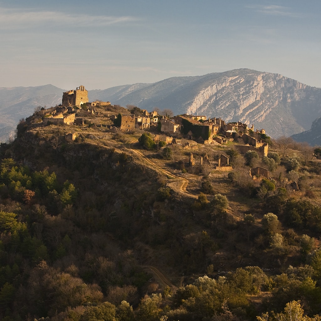
You’ll reach the conglomerate outcrop, leaving the bridle path on the left which leads from Fet to a riverside agricultural area. After climbing gently for a few metres, you’ll reach the rocky viewpoint beneath the cliff presided over by the Church of the Assumption of Mary in Fet. From here you can enjoy privileged panoramic views of Canelles Reservoir and the Sierras of Montsec d’Ares and L’Estall.
From here, continue along the trail that skirts the rock where Fet is located until you reach a crossroads from which you could once enter the town, either taking Pas de las Graeras, which would lead you straight to the town centre, or heading to the main entrance to the town, which is where you’ll find the Pillar of Our Lady of Bellmunt, the place that used to link the trails that lead to L’Estall and Finestras.
Return the way you came.