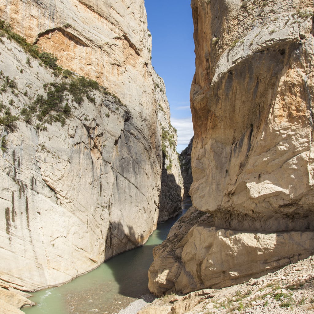
The River Noguera Ribagorzana forms a natural border between the provinces of Huesca and Lleida, and where it comes up against the might of Montsec, Mont-Rebei Gorge is born. The mountain pass cuts through 500-metre-tall cliffs for two kilometres.
The route begins in La Masieta car park, the northern gateway to the Mont-Rebei Gorge natural reserve. Straight away there’s a fork in the path, and you can choose whether to go to the reservoir (“embassament”), or instead follow the Camí de les Tarteres route (the former floods when the reservoir is full, while you can take the longer second option which avoids flooding).
Keep following the red-and-white marking that take you to Sant Jaume ravine, which you’ll cross via a suspension bridge, and in five minutes you’ll find yourself looking up at the immense size of the limestone walls of the gorge.
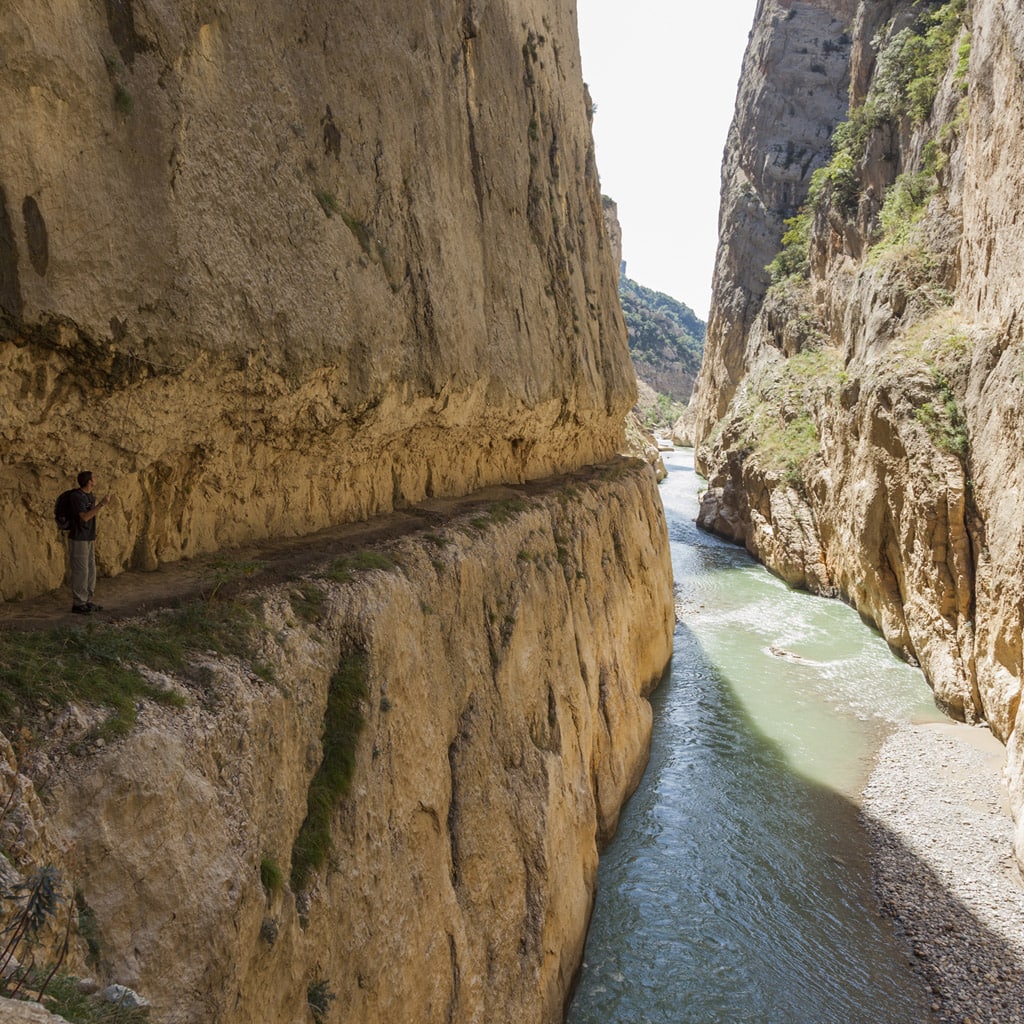
It has rope handrails from the very beginning that offer walkers safety and peace of mind, in addition to wooden benches perched on the precipice, acting as viewpoints. The path weaves through the compact limestone, penetrating at one point via a tunnel.
After a while, a steep passage opens up above the path, leading onto the Colomera and Palomera caves (570m, 45 minutes) which can be accessed using a chain and clamps.
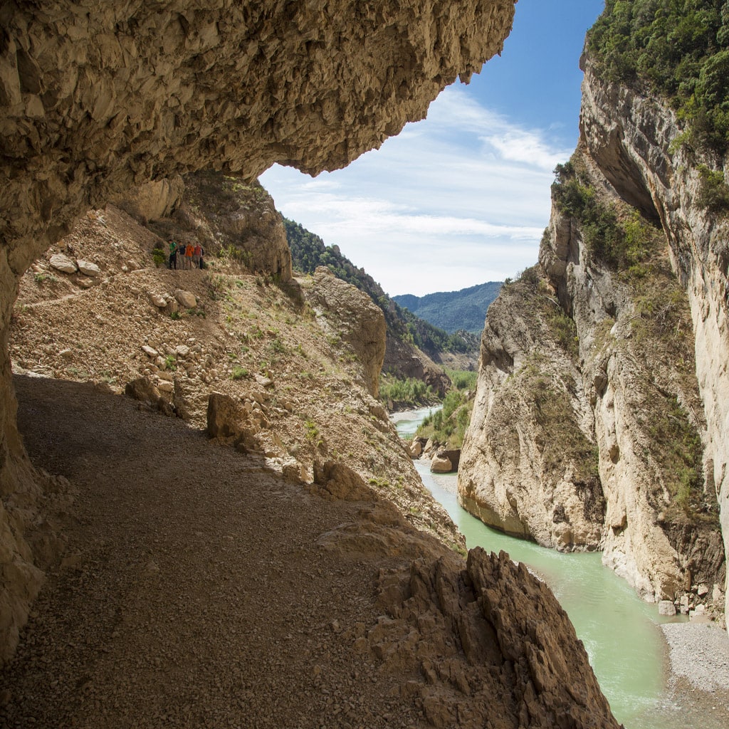
Almost immediately you’ll leave the mountain pass, opening out onto breathtaking views of Canelles Reservoir, and the path starts to climb diagonally through the Mediterranean vegetation.
After walking for around an hour and a half (4.7 km), you’ll come across the path that leads to the Montfalcó walkways route, a spectacular alternative way to get back to Montfalcó.
Remember that you can hire a kayak in Montfalcó so that you can return to La Masieta on water!