A simple descent for those who are looking for an easy activity suitable for families with children. As you head deeper into the gorge, expect breathtaking views of incredible landscapes and rock formations.
| Escape Routes | No |
| Basin | Guart – Noguera Ribagorzana |
| Flow Information | Permanent but variable flow. The River Sec access point is dry in summer |
| Access Points | Tolva (start)/Ciscar (end) |
Transfer: You can access this route from the south. Take the N-230 road which goes from Lleida to Benabarre. Before you reach Benabarre, take a right towards Caladrones and Ciscar. Pass through the town and leave the main road behind, taking the trail that goes down towards the river. Follow the trail north along the right bank of the river until you reach the southern access to the gorge. It is located around 1.5 km from Ciscar. Park your car there and, by foot, take the west-bound route that quickly turns north, reaching the high plateau before levelling out once you reach some farmland. The path is uninterrupted and it follows the edge of the field. Further along the route, it once again turns into a trail and starts to go downhill slightly. Down to the right you can see the rugged hill where Fals Castle is perched. Cross the field and head down the western face to reach the base, where you’ll find the River Sec, a tributary of the Queixigar. Here you start the descent.
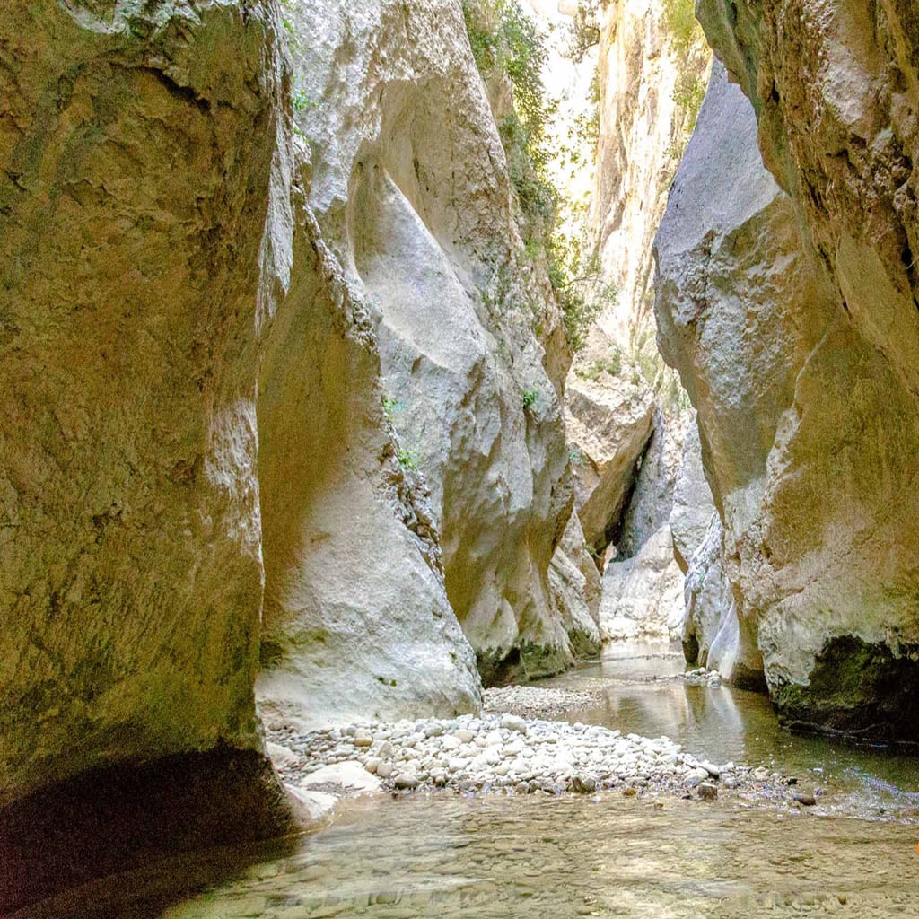
Description: Once you reach the River Sec, overlooked by Fals Castle, climb or jump over (depending on the water level) and enter a short but well-formed gorge. When it opens up, a little further ahead the river meanders to the left, which is where you’ll see the southern face of Fals Castle, and to the left we join up with the River Queixigar. Once at the confluence, the gorge starts wide, but it gradually gets narrower. Overhead you’ll find a boulder stuck between the rocks and, a few metres further along, an eight-metre-high anchor. Next you can either abseil three metres down to the left, or climb or jump down the waterfall to the right, depending on the water flow. Finally there’s a two-metre jump into a deep pothole. This is where the dark underground passage begins, which you follow in the shadows, even when the sun is at its highest point. Continue along a path that narrows and widens, with plenty of boulders blocking the way. The final 300 to 400 metres take you through a wide gorge that suddenly opens out onto a wide pebble beach area.
Start altitude: 620 m / End altitude: 580 m
Return: When the gorge opens out onto the pebbles, you’ll find your car off to the right.
Material: 20 metre rope (the tallest rappel is 8 metres high), although we recommend taking spare equipment.