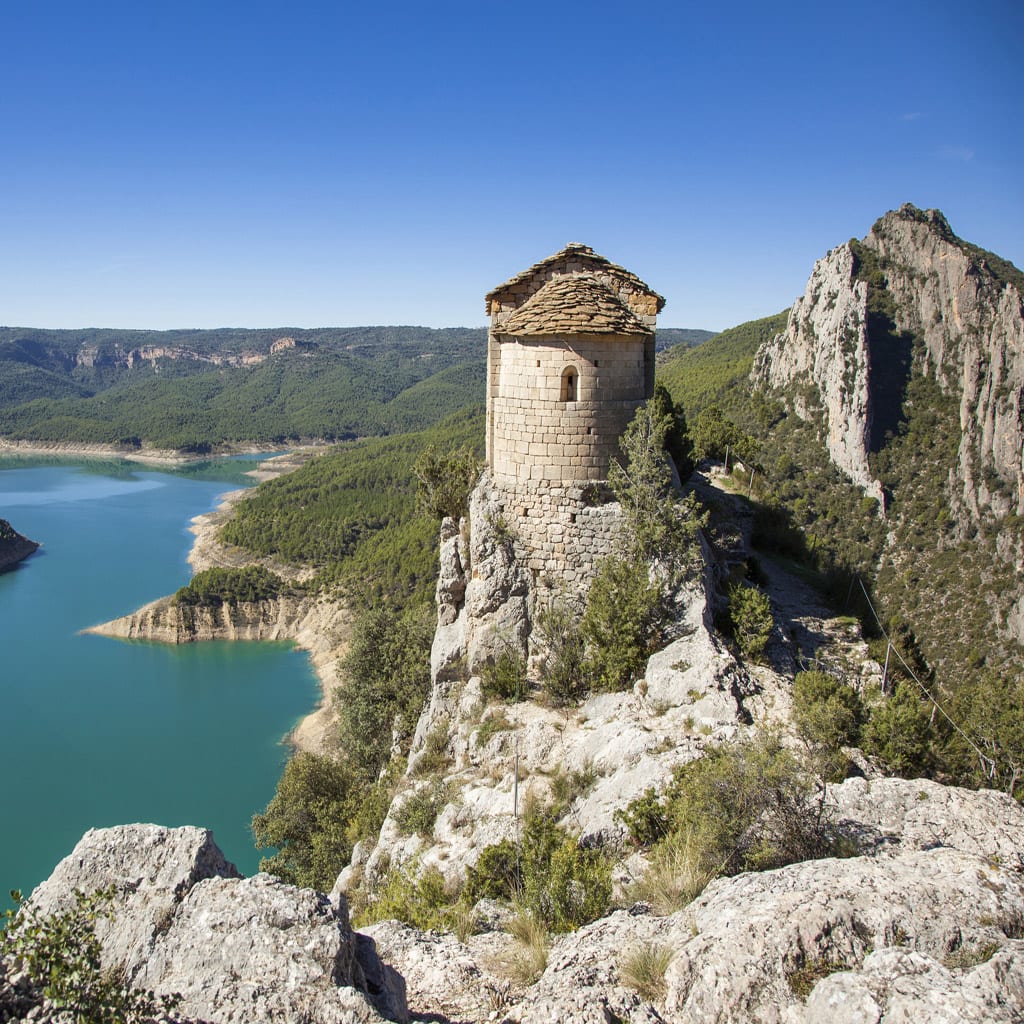
The River Noguera Ribagorzana forms a natural border between the provinces of Huesca and Lleida, and where it comes up against the might of Montsec, Mont-Rebei Gorge is born. The mountain pass cuts through 500-metre-tall cliffs for two kilometres.
The route begins in La Masieta car park, the gateway to the Mont-Rebei Gorge natural reserve. Straight away there’s a fork in the path, and you can choose whether to go to the reservoir (“embassament”), or instead follow the Camí de les Tarteres route (the former floods when the reservoir is full, while you can take the longer second option which avoids flooding).
Keep following the red-and-white marking that take you to Sant Jaume ravine, which you’ll cross via a suspension bridge, and in five minutes you’ll find yourself looking up at the immense size of the limestone walls of the gorge.
It has rope handrails from the very beginning that offer walkers safety and peace of mind, in addition to wooden benches perched on the precipice, acting as viewpoints. The path weaves through the compact limestone, penetrating at one point via a tunnel.
After a while, a steep passage opens up above the path, leading onto the Colomera and Palomera caves (570m, 45 minutes) which can be accessed using a chain and clamps.
Almost immediately you’ll leave the mountain pass, opening out onto breathtaking views of Canelles Reservoir, and the path starts to climb diagonally through the Mediterranean vegetation.
After around one hour and 45 minutes (4.7 km), you can choose to head back to Montfalcó via the natural trail that is famous for its incredible walkways and suspension bridge – the route never ceases to amaze! (See the sheet for the natural trail from Montfalcó to Mont-Rebei).
Shortly after, the trail heads through a replanted pine forest, which is when you’ll have to cross over a ravine. After a steep climb you’ll reach Mas de Carlets, which in the past was used as a refuge for hikers (6.3 km), before quickly reaching the highest point of the day (800 metres). Now you can start the descent and, after crossing La Pardina ravine, you’ll reach Collet de la Pertusa, whose hermitage is a must-see, just a five-minute detour.
The final two kilometres of the route to Corçà follows an asphalt path, taking around 30 minutes.
You can return via the same path, as it’s difficult to reach there by car.