The route to the top of Montsec is one of the most interesting ones found in the entire area, not just because it reaches the highest point of the entire mountain range, but also because the summit is a true spectacle from which you can see the peaks of the Pyrenees, as well as an enormous variety of birds.
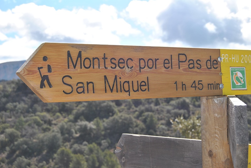
The route begins at Collado de Ramis, which is 800 metres from L’Estall (towards Montfalcó). You’ll be able to find it right away, thanks to the first panel with information on the different birds, which also indicates the starting point of the route.
There are plenty of these panels along the route, which will provide more details about the birds that inhabit the area, and if you’re lucky, maybe you’ll catch a glimpse of some of them.
Start by following the yellow-and-white signs for the PR short-distance trail, which first takes you down a farm track. You’ll quickly leave this track and take the route which leads to San Miquel ravine, before turning to the left after passing an abandoned irrigation pond. The trail weaves through oak trees before reaching the ruined San Miquel Hermitage.
Here the trail becomes narrow and zig-zags continuously until you get to the rocky steps that lead to a narrow shelf cut into the rock which climbs over the wall and takes you to the channel that comes out at the hill, Pas de San Miquel, from which you can access the peak.
From here, keep going right along the well-marked path which cuts across a dizzying corniche before reaching the summit, offering the best panoramic views of the whole mountain range.
Return the way you came.
One Way Data
Difficulty:
Medium
Altitude:
Collado de Ramis: 908 m
Pas de San Miquel: 1,235 m
Summit of Montsec: 1,331 m
Duration:
1 hour and 45 minutes
Incline:
443 m uphill
20 m downhill
20 m downhill
Length:
3,8 Km
Trail type:
Short-distance trail PR-HU-200

Previous
Next
BIBLIOGRAPHY AND CARTOGRAPHY:
- Paseos y excursiones por el Montsec de Aragón (Huesca) y el Montsec d’Arés (Lérida) (“Walks and Trips in Montsec de Aragón [Huesca] and Montsec d’Ares [Lleida]”). Vv.Aa. Publisher: Prames, 2009.
- Mapa Excursionista del Montsec I (Montsec de L’Estall y Montsec d’Ares) (“Montsec Explorer Map I [Montsec de l’Estall and Montsec d’Ares]”). Scale: 1:40,000. Publisher: Prames, 2009.
- Maps from IGN/SGE Scale: 1:50.000. Publisher: Prames.
Other ideas
For those who want to witness the beautiful landscape of the summit of Montsec but feel that the incline is too much for them, there is also the option of climbing the western side.
Leave your car at Collado de Brañal and take the PR-HU-45 towards Montgai. After 800 metres, take the trail to the right, heading south-east until you reach the summit of Montsec (4.5 km route with a 250-metre climb).